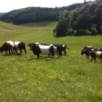
On the back of a longer running contract to monitor the effects of management on the Lugg Meadows SSSI, east of Hereford, Bioscan were asked by Herefordshire Wildlife Trust and Natural England to consider the quality of the grassland over the wider Lugg Meadows site (and latterly the nearby Hampton Meadow).
The commission (by Natural England) covered detailed quadrat sampling and phytosociological analysis of ancient ‘lammas’ flood meadow grasslands covering a large (c.135ha) area of floodplain. Quadrat data were subject to detailed statistical analysis to identify groupings and gradients within the grassland communities, and to relate these to established systems of classification such as the NVC. It was concluded that the ancient grasslands showed varying affinities to MG4, MG5 and MG8 of the NVC and that to the extent there was significant departure from these ‘nodes’ of continuum, this was explained as much by idiosyncratic elements peculiar to the site and locality as it was a representation of diminished quality.
The conclusions thus challenged work by others, including consultants employed by the Highways Agency, that had dismissed the Lugg Meadows as ‘degraded’. As a consequence of Bioscan’s report, Natural England expanded the c.15ha SSSI to cover the entirety of the c135ha site and the nearby Hampton Meadow was also designated. This was a significant factor in the Hereford Eastern Relief Road, which would have damaged or destroyed much of the site, being diverted to an alternative favoured route.
